Steve Kidd No MapsSteve Kidd MapsSteve Kidd's Maps

Well these are not my maps, of course, they are the Ordnance Survey's, and excellent they are too.

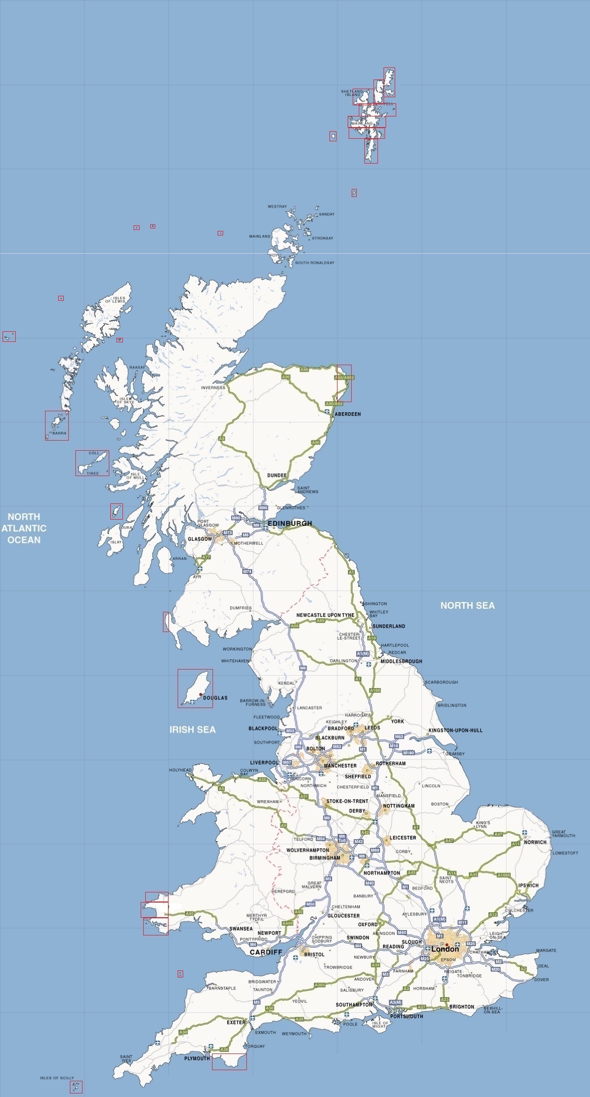
Whilst I have been putting these together I came to the conclusion that they (OS Maps) are more than excellent. They are modern collaborative art at its finest, and it seems such a shame to sully them with adverts, like on Streetmap. I do get frustrated that you can't really access decent OS maps on t'interweb, so I set about collecting them. I managed to get most of them about three years ago, but I haven't done anything with them until now. Without going into to too much detail, the map of the UK, below is divided into mostly 25 km squares that are kind of in sequence. If you click on the map you should get to that square. They are named after the large 100km sq (called a myriad) used by the OS, and numbered 01 to 16 within that square. Ocasionally I may use licence to combine maps with small features with their neighbours, for instance Beast Cliff ; maps which dont adhere to 'my' grid are generally highlighted in the red boxes. There are some maps that emulate the Ordnance Survey Land Ranger Maps and are numbered as them, and are generally 40 km square at the end of the page

The 25 km squares take much less time to download, and I figure they should do for a very decent walk or moderate bike ride. Excuse mising tiles and mistakes. I will eventually try to fix them

25 k squares

UK  Barra, Vatersay, Mingulay  Fishguard                                              Isle Of Man  Kingsbridge, South Devon  Milford Haven                                                                                                                                                                                                                                                                                                Peterhead  Portpatrick  Scilly Islands                  Mid Wenslydale  Northallerton, Thirsk  Helmsley, Kirkbymoorside  Pickering, Dalby Forest  Pately Bridge, Yorkshire Dales  Ripon, Harrogate, Knaresborough  York  Molton, Yorkshire Wolds  Bradford, West Leeds  Leeds, Wetherby  Selby, South York  Pocklington, Market Weighton  Huddersfield, Batley, Homfirth, West Dewsbury  Wakefield, Barnsly, Pontefract  Doncaster  Scunthorpe, Ouse~Trent~Humber                  Unst, Fetlar  Yell  Shetland  Mainland 1  Mainland 2  Mainland 3  Mainland 4  Foula  Fair Isle                                                                                 Aylesbury, Tring, Wendover, Chitern Hills                                  St David's, Haverfordwest                                  Camelford, Bodmin Moor  Launceston  Oakhampton, Dartmoor  Exeter  Bodmin, St Austell  Plymouth (West)  Plymouth (East), South Dartmoor)  Newton Abbot, Torbay  Mevagissey                                                                  Tiree, Coll                                              Littlehampton, Worthing, Shoreham  Hatwards heath, Brighton, Lewes  Heathfield, Hailsham, Eastbourne, Bexhill, Beachy Head  Hastings, Rye

Landranger Maps (40 k square)

Landranger 104 Leeds & Bradford, Harrogate & Ilkley
Landranger 105 York and Selby